Satellite image shows extent of Jagersfontein destruction
The South African National Space Agency (SANSA) has released satellite data to aid authorities and businesses in the Jagersfontein Dam flooding tragedy.
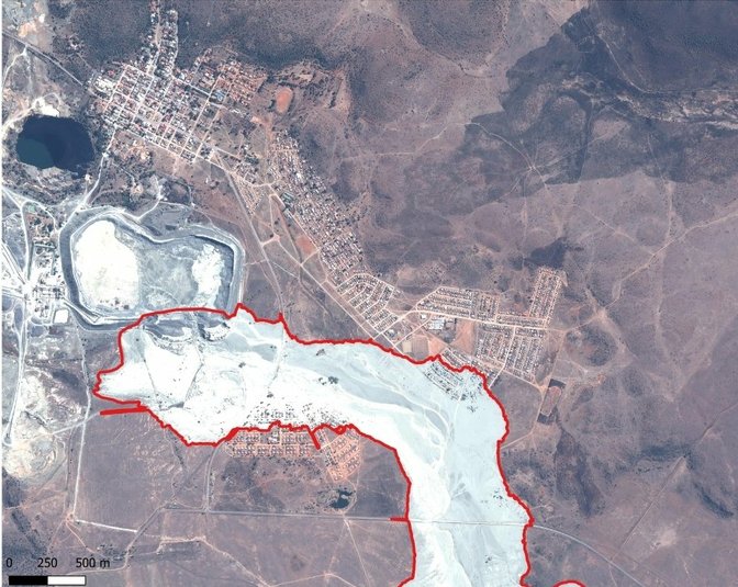
Three people were confirmed dead, houses and cars swept away and hundreds left homeless after the mine's dam wall burst on Sunday morning, sending a torrent of mud into the Free State town.
SANSA says it is analysing the satellite data to map the extent of damage to property and infrastructure in flood-affected areas.
The enormity of the disaster can be seen in the satellite footage which shows tons of mud cutting a path of destruction through the eastern and southern sides of Jagersfontein.
SANSA says the environment was also damaged, affecting the biodiversity and ecosystem along the path of the flooding water.
ALSO READ